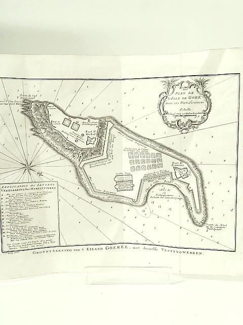
Plan de l'Isle de Gore avec ses Fortifications Grondtekening Van't Eiland Goeree, met Deszelfs Vestingwerken by None Stated
No Edition Remarks. Unpaginated. Engraved map with French style cartouche c. 1750 of the Isle of Goree, known for its role in the slave trade. Engraved by J V Schley. possibly taken from a volume by Prevost. Map has visible creasing, corner bending and tanning. Small tears to edges as well.