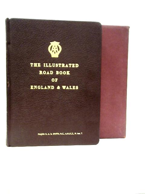
1963. Third Post War Edition. 542 pages. Fully bound in red leather with gilt lettering. Contains black and white illustrations and colour maps. Slipcase. Clean pages, illustrations and maps with light tanning and mild foxing throughout. Top textblock edge dyed gilt. Binding remains firm. Boards have mild edge-wear with slight rubbing to surfaces and bumping to corners. Gilt lettering is bright and clear. Minor peeling to spine and corners. Visible wear marks to boards. Slipcase has moderate edge wear with markings to panels and scuffing to edges.
The Illustrated Road Book of England and Wales with Gazetteer, Itineraries, Maps, & Town Plans
Old & Rare
The Illustrated Road Book of England and Wales with Gazetteer, Itineraries, Maps, & Town Plans
Summary
1963. Third Post War Edition. 542 pages. Fully bound in red leather with gilt lettering. Contains bl...
The Illustrated Road Book of England and Wales with Gazetteer, Itineraries, Maps, & Town Plans Summary
Additional information
1722854209LEE
The Illustrated Road Book of England and Wales with Gazetteer, Itineraries, Maps, & Town Plans
The Automobile Association
Used - Good
Hardback
N/A
N/A
No Jacket
N/A
542
Third Post War Editi
Book image taken of actual book.
N/A
This is a used book. We do our best to provide good quality books for you to read, but there is no escaping the fact that it has been owned and read by someone else previously. Therefore it will show signs of wear and previous use.
1963